I looked all this up so you don’t have to — but the one I actually use myself is the MRT, and I lovingly call it “the red line”, because on the map it’s a red line, same as the Underground back home.
If you grew up on the London Underground like I did, you already know how to read these maps. Find your stop on the red line, follow it in. All the lines run into the centre like a spider’s web, and you swap onto another one to head back out in a different direction. Simple once you’ve done it once.
It’s very much like the Underground, but better — cleaner, air conditioned, and you’re not crammed in like sardines.
Touch ‘n Go, and the two cards nobody explains properly
This is the bit that confused me at the start, so let me lay it out the way I wish somebody had laid it out for me. There are two separate cards, they do two different things, and you can join them together.
Card one — the Touch ‘n Go account. Download the app and apply online. It’s a proper application — you need an address, and you photograph your passport, because you have to prove who you are. Once you’re approved you get a virtual card inside the app and an account, and you can start transferring money in.
And then they post you a Visa card — a proper debit Visa, through the post. I’ve got one. If you’re an expat it’s very handy and I’d recommend it. Good app.
Card two — the rail card. Separate thing entirely. I got mine at the train station, over the counter where you buy tickets, and they topped it up there and then. You can also top up in selected shops.
And here’s the bit that ties it together: once you’ve got the Touch ‘n Go account you can add your rail card to it — and top the rail card up through the app. No queue, no kiosk, no change.
The stops I actually know
I’ll be straight with you: I’ve used one line the whole time I’ve been here. The red one. That’s it. Ignorant of me, I know — but I’ve never needed another, so I’ve never caught one, and I’m not going to pretend otherwise.
KLCC is stop number 10. That’s where I get off, every time. I’ve never gone past it — I couldn’t tell you a thing about nine and below.
My journey is about ten stops. I get on at 23 and off at 10. Around four ringgit each way, so eight there and back — under two quid for a day’s travelling.
Somewhere between 14 and 13, the train goes underground. So 13, 12, 11 and 10 are all under the ground. It’s an overground railway and an underground railway in the same journey, and it took me by surprise the first time.
Stop 14 is still above ground, and that one’s Central Market — worth getting off for if you like a browse. Good shopping.
KL Sentral I think is stop 15, and as I understand it that’s the hub — the place all the lines cross, where you get off one and get on another to head out to a different part of KL. I’ve been through it and stopped at it. That’s my understanding of it rather than a promise.
Grab or the train?
Grab costs more than the train. It’s also direct, air conditioned, and more relaxing.
Now, about the traffic. Everybody warns you the traffic here is heavy. I’d take that with a pinch of salt, and here’s why: most people saying it have never driven in London.
The traffic here is nothing compared to London. Nothing.
The longest Grab journey we’ve ever had is forty-five minutes, and that was from where we live all the way out to the airport. Even in what people here call heavy traffic, it doesn’t feel like anything to me.
And on the money — yes, it’s dearer than the train. It is not dear. A train into the centre from where I am costs a few quid. A Grab might cost you several. That extra four or five quid is nothing next to what a taxi costs at home. Loads cheaper. Not even close.
So: I’d say take the Grab. But you have got to get the train at least once, for the experience.
Rush hour is the same as it is at home. Everybody heading to work in the morning, everybody heading back around five. Give it an hour either side and you’ll be fine, on the train or in a car.
From here on, I looked it up rather than lived it
I’ll tell you plainly which is which all the way through this blog, because I’d rather you knew. I’ve never once been on a bus here, so I can’t give you a word of advice on them from experience. But I did the reading, and if you’re thinking of coming over, this is the stuff you won’t know.
The lines, in plain English
There are six lines. I use one of them. So here’s the honest version, checked in September 2026 rather than remembered.
Think of it like the Underground and you’re most of the way there — coloured lines, they all converge in the middle, you change in the centre to head back out somewhere else.
- The two MRT lines — Kajang and Putrajaya. The newest and the nicest. Mine’s one of these.
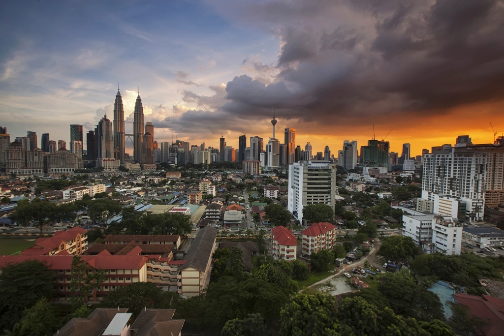
- The three LRT lines — Kelana Jaya, Ampang and Sri Petaling. Kelana Jaya is the one most visitors end up on, because it goes to KLCC, which is the Twin Towers.
- The Monorail. A little one — about eight and a half kilometres, eleven stops, running through the middle of town from KL Sentral up to Titiwangsa. It’s the one you’ll take for Bukit Bintang.
- The airport train, the KLIA Ekspres — non-stop, just under half an hour. Check the fare before you go; prices move and I’m not quoting you one that’s gone stale.
All in, that’s over two hundred kilometres of railway and more than a hundred and sixty stations. And KL Sentral is where they all meet — get there and you can get anywhere.
Straight with you: I’ve never been on five of those six. I’ve used one line, to work and back, for two years. The above is me doing the reading so you don’t have to — it is not me telling you what they’re like.
Buses, which I have never been on
Rapid KL run the buses, and the fares are low — roughly one to three ringgit. There’s also a free loop round the city centre called Go KL.
That is genuinely everything I know, and I read all of it. I’ve never set foot on one. If buses are your thing, find somebody who’s actually used them.
Women travelling on their own — the Grab thing, checked properly
My wife mentioned she’d been able to get a female driver on Grab when she’d travelled on her own. I hadn’t paid much attention, so I went and checked it rather than just repeat it.
It’s real, and it’s called Women-Only Rides. Grab Malaysia launched it in March 2026, on International Women’s Day, matching women passengers with verified women drivers.
But there are conditions, and this is the bit nobody mentions:
- Klang Valley only at the moment — that’s KL and the area round it.
- You cannot hail one on the spot. It’s advance booking only, at least 75 minutes ahead. You can book up to 90 days out.
- You have to verify you’re a woman first — a one-time thing with your MyKad or passport and a selfie.
- It was still marked as a beta — a trial — when I looked.
So it exists and it works. It is not a button you press when you’re stood outside a restaurant at eleven at night, and I’d hate for anyone to plan an evening around thinking that it is.